Last year Jose and I signed up for a membership to the Houston Museum of Natural Science. One of the things that comes along with that, in addition to discounts and that kind of thing, is a newsletter that shows up in the mailbox once every few months. I usually flip through it to see what’s going on and then toss it, and last month something caught my eye — the museum was organizing a tour of the Houston/Galveston National Weather Service office, which happens to be only a few short miles from our house! I’ve noticed their radar dome many times but had never been inside. I immediately signed us up — and it’s a good thing I did because a day later when I went back to get the link so I could send it to our friends, it was already sold out.
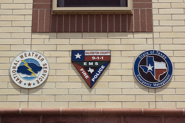
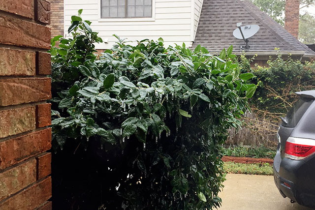
The tour was on Saturday morning and as expected, it was very interesting. (As a random aside, we were totally the youngest people there by a longshot, which made me laugh.) Their office is in Dickinson and has been there for a while. The forecaster who led the tour was Josh Lichter, and he’s worked there for 17 years. (He has a degree in meteorology from Florida State, in case you’re wondering about educational background like I was.) When he started, he must have thought he was living in the middle of nowhere, but now there’s all kinds of development around — subdivisions, retail, schools, etc. A few years ago, they moved from their old office to a new building just down the street, which they share with the Galveston County Office of Emergency Management. It’s the first weather office in the country to be co-located with emergency services, and Josh said it’s been a huge benefit to them, especially during big events like Hurricane Ike and the “ice storm” we had earlier this year.
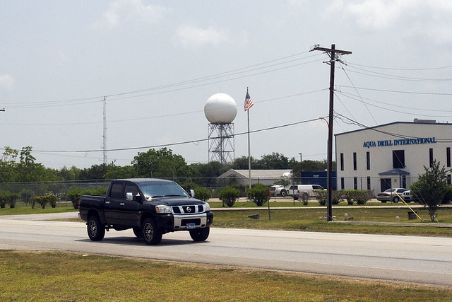
First we went outside to look across the road at the Doppler radar. Their old office was in the building right next to the radar. It takes 6 minutes for the radar to complete a full scan — it starts by scanning straight out and then incrementally changes the elevation of the dish to get the full picture of the weather at different altitudes. The Houston/Galveston office is responsible for several counties as well as offshore in the Gulf of Mexico. Fun fact #1: By the time you get up to Conroe, the radar can only see weather from about 10,000 feet altitude and up (due to the curvature of the Earth, Jose and I assumed). Fun fact #2: Their radar and all the other radars that the TV stations have are basically the same technology. So all that “Super Mega Ultimate Doppler 5000 Max” stuff that the local news advertises is a BIT exaggerated. (No surprise there.)
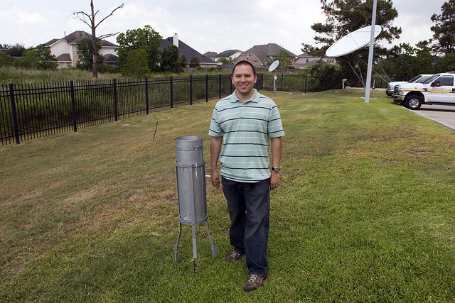
While we were outside, we also go to see the super duper high-tech rain gauge. And by super duper high-tech, I mean they have a metal bucket in the yard and every 6 hours if it’s rained, they go outside with a ruler, measure how much water is in the bucket, and empty it. Technology at its finest! As you can imagine, the bucket hasn’t been gathering much except dust lately, but while we were there on Saturday there was a small raincloud that passed over us! It rained 0.06 inches! Woo! Funny stories: they have also found critters (including snakes) in the bucket, and once they found water even when they knew it hadn’t rained. Turns out the lawn sprinklers were hitting the bucket each go-round. The only time the bucket has ever overflowed before they were able to go out and measure was during Tropical Storm Allison in 2001.
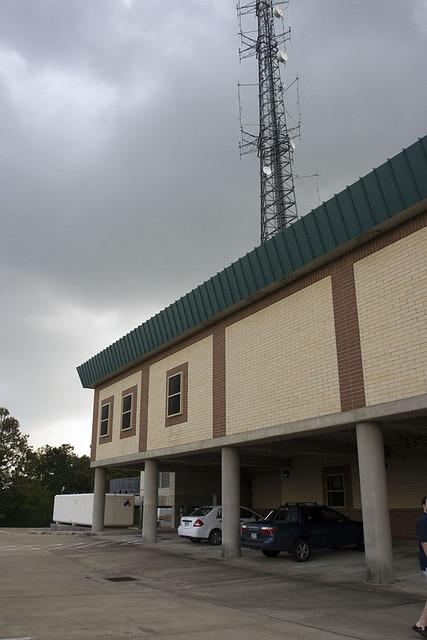
The bottom of those pillars is around 15 feet elevation, so in theory the building is safe up to 25 feet or more of hurricane storm surge. They might have issues with power though, since that big white thing in the background is their backup generator, which is good for at least a week (or maybe two weeks — I can’t remember). The radio tower is really more of an Emergency Management piece of equipment.
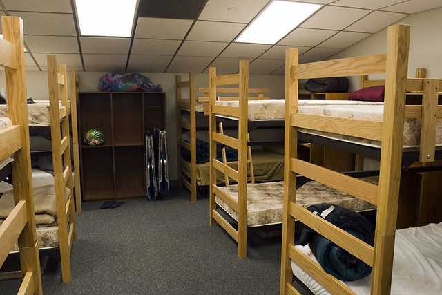
Next, we went inside and up to the third floor where there are a couple bunk rooms. Again, these are really more for the Emergency Services folks. The weather office is staffed 24/7, but obviously they go home between shifts unless some really major weather event is going on. Josh said he’s only used the bunk rooms once, I think — back in February when they were monitoring the ice storm and he wasn’t able to drive home because the roads were a bit slick. Nevertheless, they are available if needed.
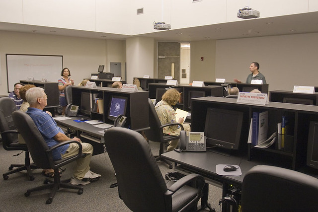
Overall, it’s a pretty standard office with no big surprises but they do have a couple features that will seem quite familiar to NASA-junkies because it’s a lot like our Mission Control Center. This room is mainly for GCOEM and has consoles for various departments — everyone from the county judge (or a representative from that office) to the weather service to representatives for each division in the county. FYI to fellow League City residents: we are in the North Division along with Dickinson, Friendswood, Clear Lake Shores, and Kemah.
From there, we went into a conference room where Josh showed us all kinds of cool computer tools the forecasters use to do their job. He showed us all kinds of radar images and satellite images. We saw the huge high pressure ridge that’s been parked over Texas for weeks that’s keeping all the much-needed rain away. He talked about weather balloons and how they get their data and computer models that help them predict what will happen, and how things have changed over time as technology has improved. We saw the smoke from the Arizona wildfires on the satellite image. We saw how clouds form over land but the skies over bodies of water stay clear longer because it takes more time for water to heat up during the day.
We asked lots of questions about watches and warnings and who’s responsible for what. Fun facts: tornado warnings (i.e. a tornado has been spotted in person or on radar) are issued by the local office, but tornado watches (i.e. conditions are favorable) are issued by the Storm Prediction Center in Oklahoma. Hurricane watches and warnings are issued by the National Hurricane Center in Miami. Flash flood watches and warnings are issued by the local office. The local office also handles marine and aviation forecasts, as well as the regular local forecast, so they have a ton of products that they’re responsible for. The National Weather Service is the only entity legally allowed to issue watches and warnings, so while the Weather Channel and local stations and all sorts of other entities may do their own forecasting, they cannot issue watches or warnings themselves.
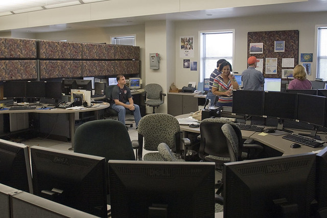
Houston/Galveston NWS Operations Room
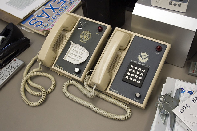
At the end of the tour, we finally got to see the NWS operations center, which was surprisingly low key. There are 4 desks — if I remember correctly, one is for the Forecaster on duty, one is for someone handling the marine and offshore weather, one that is the Public Service desk that publishes updates and handles the weather radio broadcast, and one desk that’s available for “standby” support if needed. (Josh said the fourth person would usually be monitoring the radar during big storms or other events.) All of the NWS offices work together to provide backup to each other if necessary. If something caused the Houston/Galveston Office to go down, the Dallas/Ft. Worth, Austin/San Antonio, Corpus Christi or Lake Charles offices could all cover for them. The office also has direct lines to the Hurricane Center and to the National Warning System.
Overall, it was a very neat tour and I learned a lot. If you are interested, the Houston/Galveston Office has a TON of information available on their website — everything from the standard weekly forecast to drought information to weather briefings from the forecasters and of course the local radar. (I finally learned what the difference is between the “base reflectivity” and “composite reflectivity” on the radar! Base is just at the base level, i.e. the lowest the radar can see, but composite includes all altitudes.) They also have a Facebook page and will be on Twitter soon. They even have a sense of humor: “Monday: Showers likely, mostly cloudy with a high near 62 (in Seattle, WA). Otherwise…more of the same dryness and heat here in SE Texas.”
But one of the coolest things I learned is how much interaction they have with the public. They really do depend on reports from anyone and everyone to help them keep track of what goes on in their area — you can post to their Facebook page (last week some people in Galveston were able to post photos of waterspouts that the NWS had not predicted) and they even have a program called Skywarn where you can take a short, free training course and become an official storm spotter.
I am now ready to be an expert armchair meteorologist! Watch out world!




Sarah, being an armchair meteorologist, you might wat to take a read of Isaac’s Storm by Erik Larson. A great book about the 1900 Galveston Hurricane. It’s a great read!
I read it a few years ago — indeed, a great read!
Cool writeup, thanks.
Great post! Loved the photos – felt like I was there!
There are so many fun things like this around Houston. The trick is to find them. I would love to know what it is going to take to move this high pressure system. I’m not even sure a hurricane could get in here it feels so thoroughly entrenched.
Ugh, I know! I’m so ready for some rain and a bit of relief from this heat!